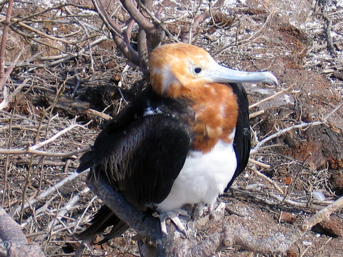
Volcanoes of Ecuador Itinerary
Everything from the airport pickup to the shuttle back to the airport went smoothly. AAI is a well oiled machine. I would not climb with anyone else. – Volcanoes of Ecuador Climber
Day 1
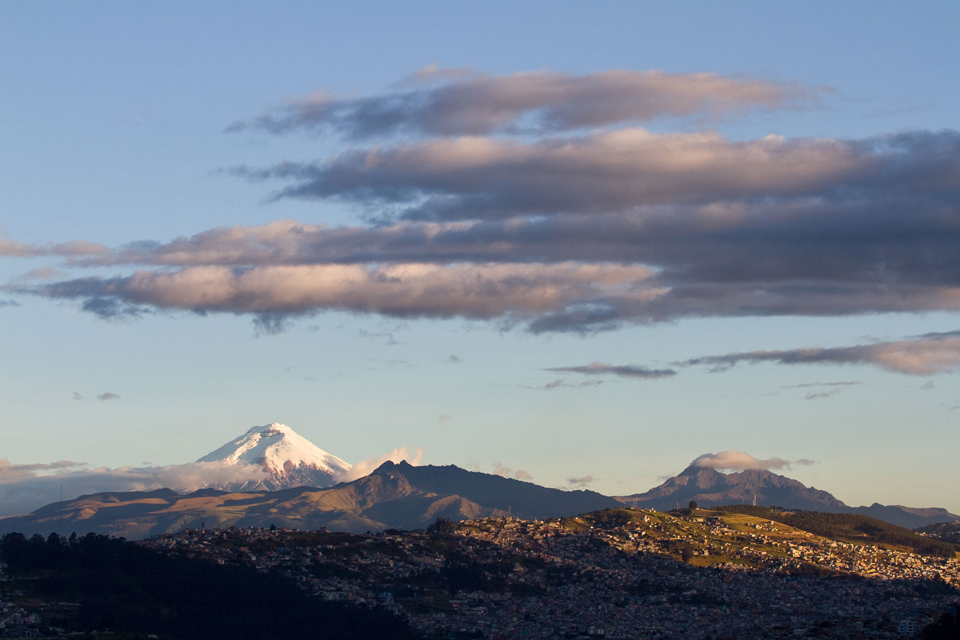
Arrival in the capital city of Quito. Quito lies on a long and narrow Andean valley surrounded by high volcanoes at an elevation of 9,350 ft. Our guide will be waiting for you at the airport and will take you to the hotel.
- Altitudes: Quito: 9,350 ft.
- Travel times: Airport – Hotel: 45 min
- Accommodations: Hotel with WiFi and cell phone signal
Day 2
City Tour of Quito
We will spend the day sightseeing in Quito. The northern capital for the Incas, Quito is considered one of the most beautiful of all South American capital cities with its well-preserved colonial architecture and mild climate. We will visit the old town of Quito, which has been declared a World Heritage by the UNESCO. Here we can acclimatize to the local altitude while taking an easy walk through narrow streets and historic squares, admiring the old colonial churches and houses. Before returning to our hotel, we will enjoy a great view of Quito from the top of the El Panecillo hill. This day is an important foundation for our acclimatization. We will also have a thorough equipment check and orientation. Overnight stay in Quito.
- Altitudes: Quito: 9,350 ft.
- Travel times: Hotel – old town: 30 min; Old town – Hotel: 30 min
- Accommodations: Hotel with WiFi and cell phone signal
Day 3
Pasochoa Climb
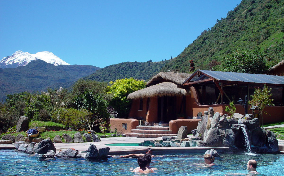
Easy access from Quito makes Pasochoa (13,776 ft.) a great acclimatization hike. Our private bus will take us up to an altitude of 11,794 ft. From there we will start our three-hour hike to the top of this ancient volcano, where we will see three of the highest snow-capped Ecuadorian mountains: Cotopaxi, Antizana, and Cayambe. Two hours later we will return to the bus and drive to the most beautiful hot springs spa in Ecuador, Termas Papallacta. Papallacta has private hot pools in front of every room that are filled daily with perfectly clear hot water from their natural hot springs. The spa is also available for massages at very reasonable prices. We spend the rest of the evening enjoying a great dinner and relaxing in the pools. Overnight at Papallacta.
- Altitudes: Mettler parking land: 11,794 ft.
Summit Pasochoa: 13,776 ft.
Termas Papallacta: 10,827 ft. - Vertical gain climbing: 1,981 ft.
- Vertical gain of sleeping altitude: 1,477 ft.
- Travel times: Hotel – Mettler parking land: 1 hour
Mettler parking land – Papallacta: 2 hours - Hiking/climbing times: Mettler parking land – Summit Pasochoa: 3 hours
Summit Pasochoa – Mettler parking land: 2 hours - Accommodation: Resort with Wi-Fi and cell signal
Day 4
Parcacocha Lake
We will take an acclimatization hike through a beautiful group of mountain lakes up onto the high ridges surrounding Papallacta. This hike has excellent views of Lake Parcacocha, the surrounding valleys. After our hike, we head back to Termas Papallacta for a fine dinner and another evening an the spa.
- Altitudes: Termas Papallacta: 10,827 ft.
Trailhead: 12,247 ft.
Parcacocha Lake: 13,350 ft. - Vertical gain climbing: 1,103 ft.
- Travel times: Termas Papallacta – Trailhead 20 min
- Hiking/Climbing time trailhead – Parcacocha Lake: 3–4 hours
- Accommodations: Resort with Wi-Fi and cell signal
Day 5
Hike to Antennas Peak
We will do a short acclimatization hike from the Papallacta High Pass to the top of the Antennas Peak (14,406 ft.) with great views of Antisana, Cotopaxi, and Cayambe. We then travel to the foot of Cayambe and check in at the Yanacocha Lodge. This recently revamped lodge is located in the Andean grasslands with a fantastic view of Cayambe.
- Altitudes: Papallacta High Pass: 13,336 ft.
Antennas Peak: 14,406 ft.
Yanacocha Lodge: 11,982 ft. - Vertical gain climbing: 1,070 ft.
- Travel times: Termas Papallacta – Yanacocha Lodge: 3 hours
- Hiking/Climbing times: Papallacta High Pass – Antennas Peak: 2 hours
- Accommodation: Yanacocha Lodge with Wi-Fi and spotty cell signal
Day 6
Glacier skills review on Cayambe
After breakfast we travel by four-wheel drive up to the Cayambe Hut. From here we hike for an hour up to the glacier for a climbing skills review and to acclimatize. That evening we return to the Yanacocha Lodge for dinner.
- Altitudes: Yanacocha Lodge: 11,982 ft.
Cayambe Hut: 15,282ft
Cayambe Glacier: 16,070ft - Vertical gain during the day: 4,088 ft.
- Vertical gain climbing: 788 ft.
- Travel times: Yanacocha Lodge – Cayambe Hut: 40 min.
- Hiking/climbing times: Cayambe Hut – Glacier: 1 hour
Glacier- Cayambe Hut: 40 min - Accommodation: Yanacocha Lodge with Wi-Fi and spotty cell signal
Day 7
Cayambe Hut. Preparation for Cayambe summit.
Today we will move up to the Cayambe Hut, which is situated on the southern slopes of Cayambe and has fantastic views of “Glaciar Hermoso.” Once at the hut, we spend the day planning the climb and preparing our gear. We will head to bed early so that we are well-rested for an early departure on the summit climb.
- Altitudes: Yanacocha Lodge: 11,982 ft.
Cayambe Hut: 15,282 ft. - Vertical gain climbing: 0
- Travel times: Yanacocha Lodge – Cayambe Hut: 40 min.
- Accommodation: Cayambe Hut. No internet access, no cell signal
Day 8
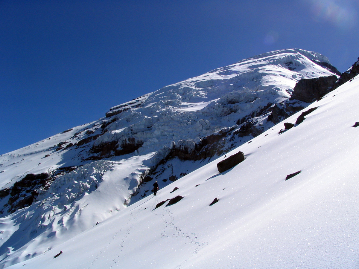
Cayambe summit day
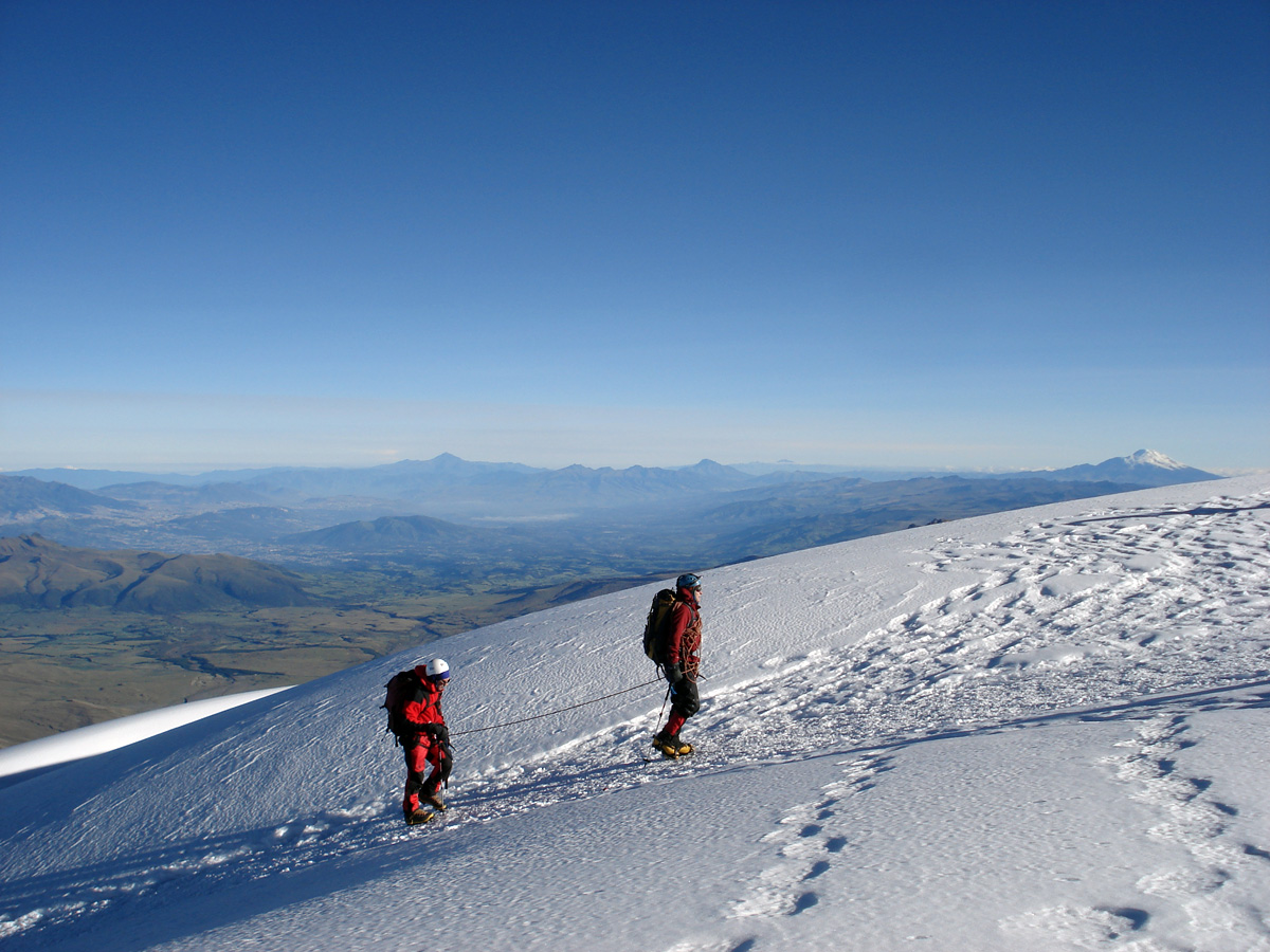
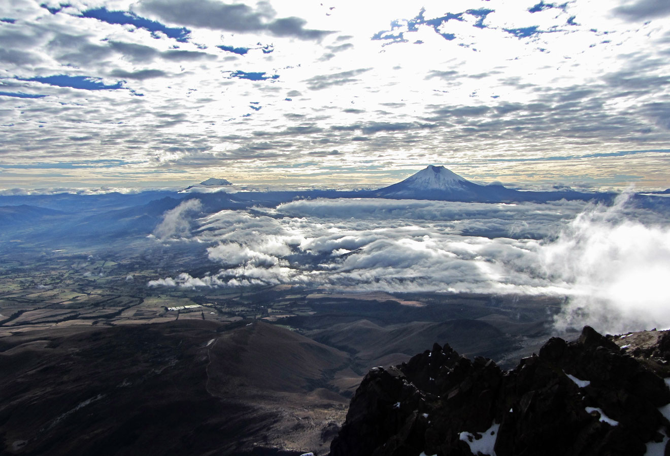
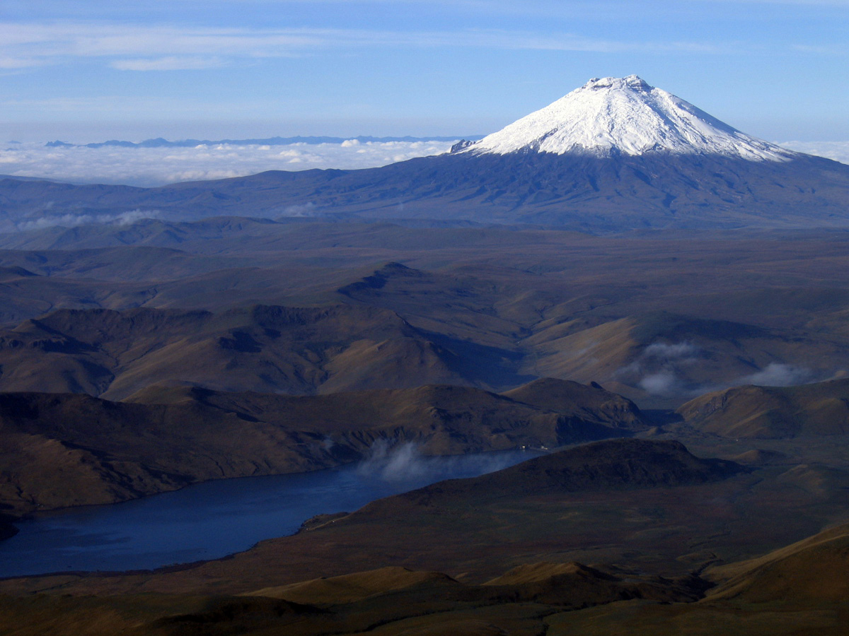
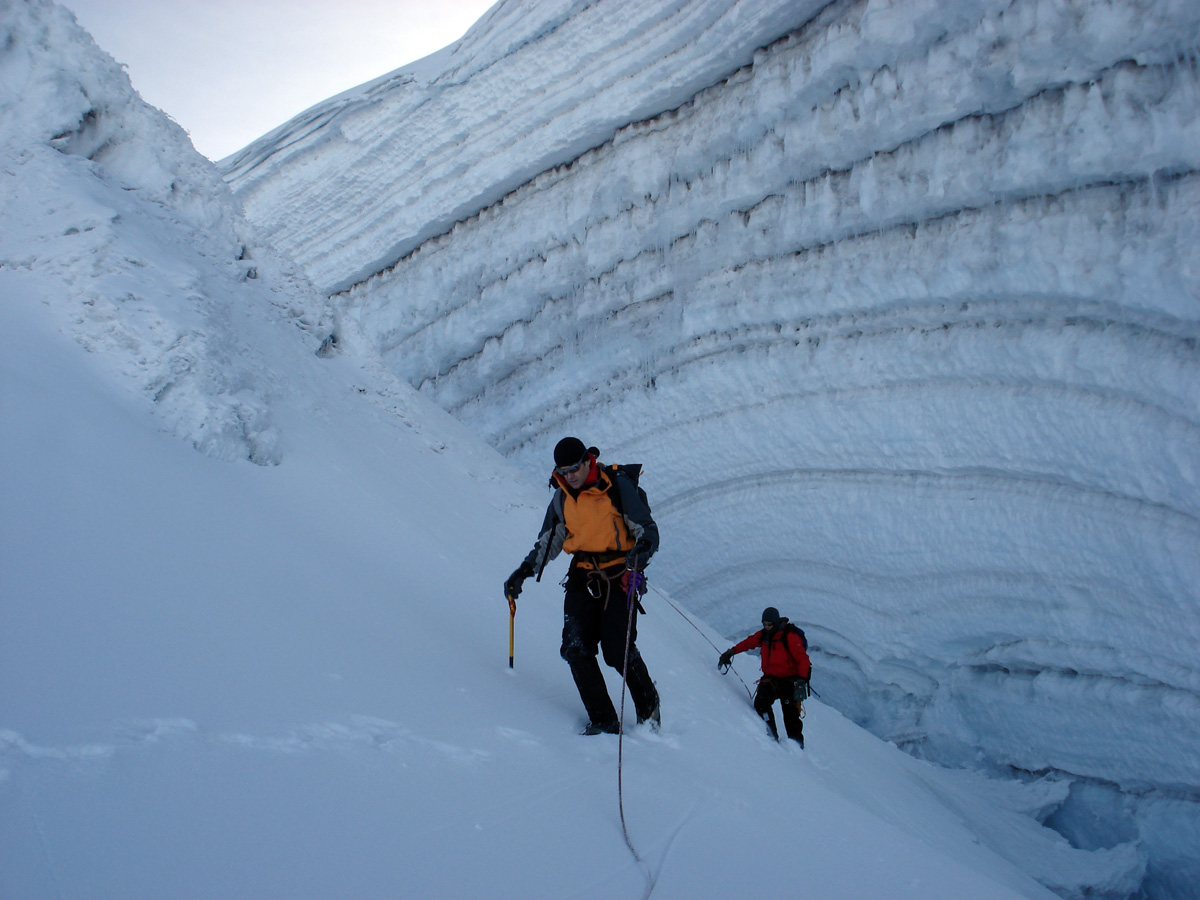
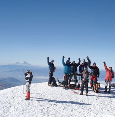
Cayambe, the third highest mountain in Ecuador, has the special distinction of being the highest and coldest point on the equator. This volcano is the only place on Earth where the latitude and temperature are both 0 degrees. We begin the climb at about midnight. This early start allows us to take advantage of better snow conditions and so we can travel more efficiently and safely. The normal route is not challenging technically, but it is physically demanding. From the hut we will ascent to the top of a rocky ridge, then make a short descent before heading up to join the glacier. Once on the glacier, we will rope up and head toward a rocky outcrop in the middle of the glacier. From there, we work our way through crevasses until reaching the huge summit dome (18,993 ft.) with magnificent views of the Amazon Rain Forest, the surrounding highlands, and mountains such as Antisana and Cotopaxi. After the summit, we descend Cayambe and head to Hacienda Cusin for rest and recovery.
- Altitudes: Cayambe hut: 15,282 ft.
Summit Cayambe: 18,993 ft.
Yanacocha Lodge: 11,982 ft. - Vertical gain climbing: 3,711 ft.
- Travel times: Cayambe Hut – Yanacocha Lodge: 40 min.
- Hiking/Climbing times:Cayambe hut – Summit Cayambe: 8 hours
Summit Cayambe – Cayambe hut: 3 hours - Accommodation: Hacienda Cusin
Day 9
Rest/travel day
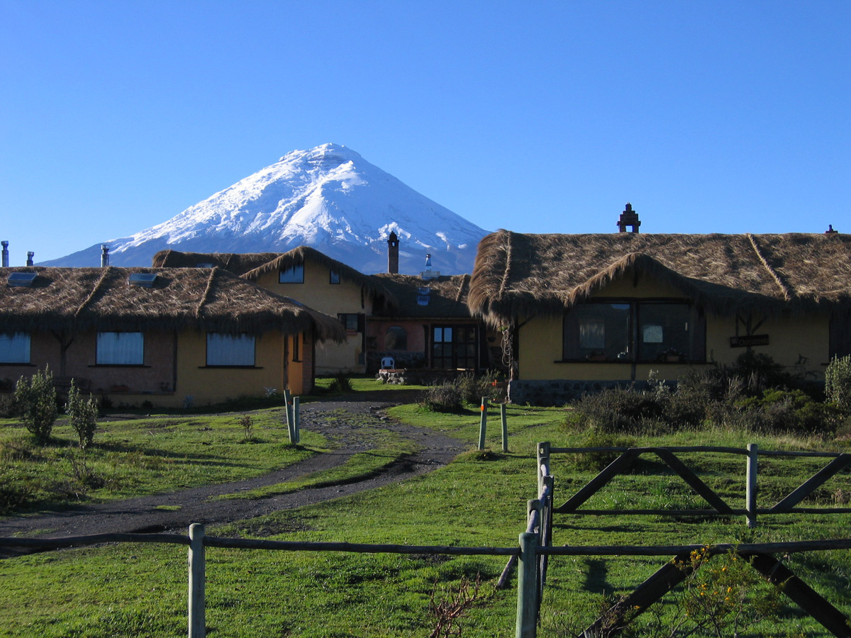
Today we have a rest day. We will visit Otavalo, home of the largest market in South America, where we can peruse world famous textiles, artisanal crafts, leather goods, jewelry, and more. We then travel to Cotopaxi National Park, the showpiece national park in all of mainland Ecuador. We stay at Hacienda Los Mortiños, a beautiful farmhouse on the edge of the park boundary.
Day 10
Hike to Refugio José Rivas
From our hacienda we drive into the national park and up to the parking land on Cotopaxi. From here we start the climb of the second highest mountain in Ecuador. It’s a short hike to the refuge, where we’ll spend the rest of the afternoon resting and preparing for tomorrow’s summit climb.
- Altitudes: Park land Cotopaxi: 15,230 ft
Refugio: 15,900 ft. - Hiking time: ~1 hour
- Accommodation: Refugio José Rivas. No Wi-Fi, no cell service.
Day 11
Cotopaxi summit day
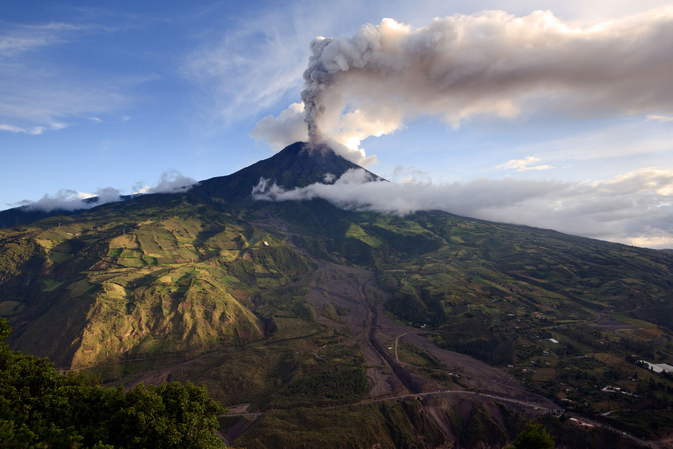
We begin the climb at about 1:00am. An early start allows us to take advantage of the better snow conditions and thus travel more efficiently and safely. The normal route is not challenging technically but is physically demanding. It involves climbing on moderate glaciated slopes (generally 30° – 45°). After approximately seven hours of climbing we reach the top where we can enjoy magnificent views of the gigantic crater and mountains such as Antisana, Cayambe, and Chimborazo. After the summit, we descend Cotopaxi and head to the scenic town of Baños. Baños is considered the gateway to the Amazon rainforest, and is known for its waterfalls and mineral-rich hot springs.
- Altitudes: Refugio José Rivas: 15,900 ft.
Summit Cotopaxi: 19,347 ft. - Vertical gain climbing: 3,447 ft.
- Hiking/climbing times: Cotopaxi hut – Summit Cotopaxi: 7 hours
Summit Cotopaxi – Park land Cotopaxi: 3 hours - Travel times: Park land Cotopaxi – Baños: 3 hours
- Accommodation: Resort with Wi-Fi and cell service.
Day 12
Rest day in Baños
Today we’ll enjoy a well-earned rest day in the beautiful town of Baños. In the morning we’ll have a casual visit to Ruta de las Cascadas, or the Avenue of Waterfalls. The afternoon will be free to relax in the hot springs for which Baños is famous. The city’s full name is actually Baños de Agua Santa, which means “Baths of Holy Water.” The thermal baths here are fed by springs from the surrounding volcanoes. The mineral-rich waters not only feel amazing, they’re also good for you. Prioritizing our recovery this day will go a long way for our final challenge of Chimborazo.
- Altitudes: Baños: 6,000 ft.
- Accommodation: Resort with WiFi and cell signal
Day 13
Castle Camp on Chimborazo
Chimborazo (20,548 ft.), our next objective, is the highest mountain in Ecuador. Its main summit has the distinction of being the farthest point from the center of the Earth, making Chimborazo, in its own way, the tallest mountain in the world. From any side that you look at Chimborazo, it will impress you by its sheer size and beauty. We travel by bus to Plaza Roja, located close to the Carrel Hut. From there, we will hike about two hours to Castle Camp, where we spend the afternoon preparing for the climb the next day.
- Altitudes:
Plaza Roja: 15,918 ft.
Castle Camp: 17,388 ft. - Travel times: Baños – Plaza Roja: 2 hours
- Hiking times: 2 hours
- Accommodation: Castle Camp, no internet or cell signal
Day 14
Chimborazo summit day
We start the climb at about midnight following the rocky section of the Castle ridge until it joins the Castle Saddle (18,044 ft.). From the Castle Camp, it normally takes six to seven hours to get to the Whymper summit from where you will enjoy one of the best views in Ecuador. To the east and southeast are El Altar, the most difficult mountain to climb in Ecuador, and the active volcanoes Tungurahua and Sangay. To the north and northeast are mountains such as the Ilinizas, Antisana, and the famous Cotopaxi. The descent to the Castle Camp takes three hours. After returning to camp, we will pack and descend to Plaza Roja, then travel to Riobamba town. The Abraspungo Hostelry gives us beautiful Andean scenery at the end of our climb
- Altitudes: Castle Camp: 17,388 ft
Summit Chimborazo: 20,548 ft.
Plaza Roja: 15,918 ft.
Abraspungo Hostelry: 9,022 ft. - Vertical gain climbing: 3,159 ft.
- Travel times: Plaza Roja – Abraspungo Hostelry: 1 hour
- Climbing times: Castle Camp – Summit Chimborazo: 6 – 7 hours
Summit Chimborazo – Castle Camp: 3 hours
Castle Camp – Plaza Roja: 1.5 hours - Accommodation: Abraspungo Hostelry with WiFi and cell signal
Day 15
Return to Quito
After breakfast we will drive along the Avenue of the Volcanoes back to Quito. Farewell dinner in the evening.
- Travel times: Riobamba – Quito: 4–5 hours
- Accommodation: Hotel with WiFi and cell signal
Day 16
Depart Quito for home.
- Hotel to airport: 45 minutes
Cotopaxi Express Itinerary
Day 1 (Saturday)
Arrive in the capital city of Quito. Quito lies on a long and narrow Andean valley surrounded by high volcanoes at an elevation of 9,350 ft. Our guide will be waiting for you at the airport and will take you to the hotel.
Day 2 (Sunday)
City Tour of Quito
We will spend the day sightseeing in Quito. This day provides an important foundation for our acclimatization. We also have a thorough equipment check and orientation. A welcome dinner follows in the evening. Overnight stay in Quito.
Day 3 (Monday)
Acclimatization hike of Pasachoa (13,800 ft.)
We leave around 8 a.m. for a 5-hour hike up Pasochoa. Pasochoa is an ancient and heavily eroded volcano that has been inactive since the last ice age. If the weather permits, from the summit, we will be able to take a good look at the crater. Inside you will see the Pasochoa Protected Forest Reserve, a humid Andean Forest with more than 110 species of birds and 45 species of trees, located between 8,856 ft and 13,776 ft. On a sunny day you can see condors. After descending back to the van, we drive to Casa Ilayaku for the night.
Day 4 (Tuesday)
Acclimatization hike of Corazon (15,704 ft.)
Corazon is another eroded and extinct volcano located southwest of Quito. The name Corazon means “heart” in Spanish and is said to refer to two gullies on the north west slopes which, when seen from the distance, appear to join together in the shape of a heart. The hike takes several hours and is an excellent progression after Pasachoa before we head into the alpine. On a clear day you have views of the “Avenue of the Volcanoes,” including Chimborazo, Cotopaxi, Cayambe, Ilinizas and Antisana. We’ll then travel to Chuquirahua Lodge for the night.
Day 5 (Wednesday)
Hike to Refuge Nuevos Horizontes (15,388 ft.)
From the Chuquirahua lodge we’ll drive up towards Iliniza. The road ends just below 13,000 ft, where we’ll start our hike up to the Nuevos Horizontes refuge at 15,388 ft. This beautiful trail starts in lush green grass and ends in the alpine perched between Iliniza North and Iliniza South. At the refuge we’ll get comfortable and have lunch and hot drinks. Later in the afternoon we’ll review technical skills around the hut while our bodies acclimate to the altitude.
Day 6 (Thursday)
Iliniza North summit day (16,818 ft.)
We wake up early for an alpine start to make our ascent of Iliniza North. We’ll depart the hut around sunrise and climb the South Ridge. This gorgeous alpine ridge climb has sections of class 3 and 4 scrambling with incredibly scenic views as we pass over towers and wind around rock formations making our way towards the summit. We’ll take a nice break at the summit and soak in the 16,800 ft. elevation! After summit photos and high fives, we will descend back down to the hut and retrace our steps back to the trailhead. That evening we drive to a historic hacienda near Cotopaxi for a delicious meal and rest.
Day 7 (Friday)
Cotopaxi hike to Refuge Rivas
From our hacienda we drive to the parking land of Cotopaxi at 15,088 ft. From here we hike for 45 – 60 minutes to the Jose Rivas Refuge at 15,750 ft. We will eat dinner there, make final preparations for our climb, and retire early to rest for our alpine start.
Day 8 (Saturday)
Cotopaxi summit day (19,347 ft.)
After having a light breakfast at the refuge, we will start the climb of the second highest mountain in Ecuador. We begin the climb at about 1AM. An early start allows us to take advantage of the better snow conditions and thus travel more efficiently. The normal route is not challenging technically but is physically demanding. It involves climbing on moderate glaciated slopes (30° – 45°). After approximately six hours of climbing, we reach the top where we can enjoy magnificent views of the gigantic crater and mountains such as Antisana, Cayambe, and Chimborazo. Our descent to the refuge takes about two hours. After resting and packing, we’ll return to Quito this evening.
Day 9 (Sunday)
Depart Quito for home
Depending on your flight time, you may have the chance to sleep in, get out on the town and pick up some last souvenirs. We will transfer you back to the airport for your return flight home. It is best to schedule your flight for a mid-day/early afternoon departure.
Itinerary subject to change.
I felt like, with Jose Luis, I was in the hands of one of the best guides in Ecuador. He is fun to be with and had a great rapport with the group. The trip was extremely well-organized, and I had fun the entire time. Overall I thought the organization of the trip was flawless.