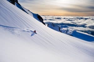
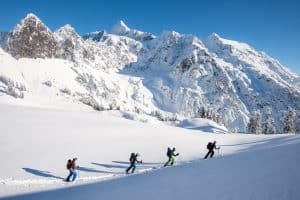
When conditions are prime for winter backcountry adventure, it’s easy to get caught up in the stoke and overlook essential pre-trip preparation in a rush to get on the skin track. In this webinar, guide and backcountry powder chaser, Elias Zane Holt, lays out how to plan a successful and safe trip into the mountains, with insider advice on digital mapping tools, gear selection, and other tools to help you style your next trip.
Here are some helpful links to trip planning resources that Elias mentioned during the webinar:
Online Message Boards + Trip Reports
- Turns all Year – Online space that can serve skiers and riders in the PNW and beyond.
- Climber Kyle – A treasure trove of trip reports, mostly from the PNW.
- Cascade Climbers – Route reports, climbing partner finder, gear sales, and much more.
- Mount Rainier Climbing Blog – Tahoma specific conditions blog maintained by MRNP climbing rangers.
- North Cascades National Park Conditions – North Cascades route conditions blog maintained by NCNP climbing rangers.
- Mountain Project – Climbing routes, photos, and guides for every state, along with experiences and advice from fellow climbers.
Mapping + Tour Planning Apps
- Gaia GPS – Mapping app with slope angle shading, topo, satellite layering, and even snow depth and avalanche forecast overlays.
- CalTopo – Mapping app that is great for pre-planning/plotting trips in advance with lots of functional layers like slope angle shading as well.
- OnX Backcountry – Mapping app that comes with many backcountry tours already pre-loaded!
- Guide Pace – Time planning for the mountains.
Guidebooks:
- Beacon Guidebooks – Backcountry ski guidebooks to be used in the ski tour planning process as well as out in the field to ensure balanced and informed decision-making.
- Rakkup App – Downloadable backcountry skiing and climbing guidebooks for your phone.
- Backcountry Ski & Snowboard Routes: Washington – A guide to the very best routes available to skiers and boarders throughout the state.
- Classic Cascade Climbs: Select Routes in Washington State – More than 100 climbing routes across 70-plus peaks as well as a handful of sport, ice, and crag options.
- Sharp End Publishing – Award-winning climbing guidebooks
- SuperTopo Guidebooks – Each guidebook contains detailed SuperTopos for each climb, approach and descent information, as well as route histories.
Weather Resources:
- Windy – Weather radar, wind and waves forecast.
- NOAA – Check out the point forecast feature.
- Wunderground – Local & long-range weather forecasts, weather reports, maps & tropical weather conditions for locations worldwide.
- Mountain Weather Lite – A selection of the most commonly used weather maps & forecast tools, all on one page.
- WA Local Weather Station – Mountain weather forecast for WA.
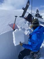
Avalanche Education:
- AIARE Level 1 – This comprehensive 24-hour course introduces students to the necessary decision-making tools for managing risk while traveling in avalanche terrain. It is designed for all individuals recreating on snow in the mountains whether skiing, split-boarding, snowshoeing, climbing, or mountaineering.
- Know Before You Go – The program introduces you to avalanche safety with some simple steps you can take to stay safe and have fun in avalanche terrain.
- Avalanche.org – Connects the public to formal avalanche information and education in the United States. Find the avalanche encyclopedia here!
Don’t Forget to Check Driving Conditions!